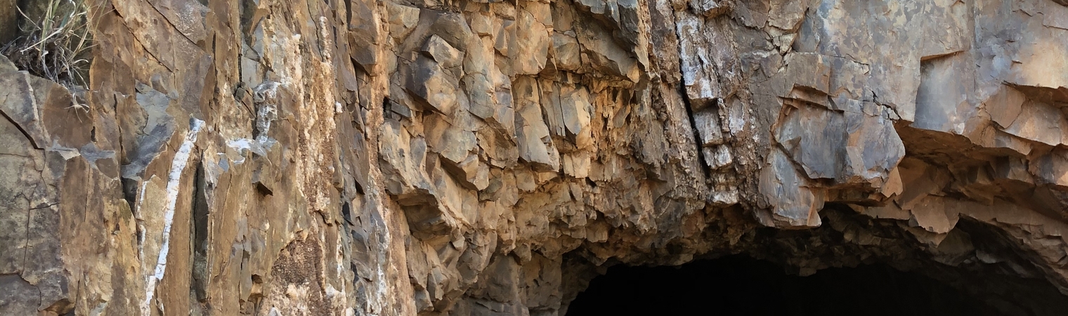
The Little Granite Project
High-grade historic gold-silver epithermal vein system
The Little Granite is a historic high-grade past producing high-grade gold and silver mine consisting of four claims, hosted in tertiary volcanics. The style of gold-silver mineralization in the region is classified as low-sulphidation epithermal, with the precious metal mineralization being hosted within quartz and carbonate veins in altered volcanic rocks. This type of mineralization is recognized globally and is associated with some of the highest-grade gold-silver mines, such as Hishikari in Japan, Fruta del Norte in Ecuador and Midas in Nevada.
Locally, the mineralized veins are generally related to north-south trending faults. The dominant geological structure controlling the area is the Rio Grande Rift, which extends into northern New Mexico, where it is associated with over forty historic gold and silver mines within the district encompassing our claims. The main vein has been traced for over 200 metres through past drilling and underground workings, and it remains open along strike to the north and south, and at depth. Historically reported high grade values were confirmed through limited resampling by Foremost Lithium in late 2020. Historic reports suggests the vein widens to approximately 3m (10ft) at depth.
Recent Exploration Success
Ore characterization sampling from the historic mines within the project returned bonanza-grade results from the Little Granite. The precious metal horizon is encountered within several hundred feet of surface, and outcropping veins are observed to transition along their strike-length and in areas where drainages expose lower levels. Copper is present within the precious metal-horizon, and elevated lead and zinc are anticipated beneath the prospective ore zone.
The Little Granite was most recently visited in September 2023. During these visits, the mine site, workings, and dumps were walked and inspected to collect representative samples of the different styles of mineralization. The team also assessed the best options for access and logistical support for the planned Phase 1 program. A sampling program conducted in 2021 returned exceptional results as outlined in Table 2 below.
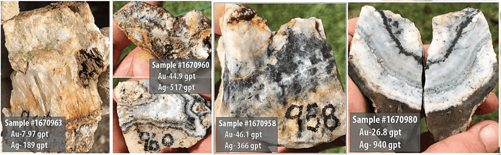
Picture 1. Samples collected at Little Granite Ivanhoe/Emporia Program and correspond with Table 2 below
Table 1 displays the ore characterization of the samples collected from historic mine dumps (none omitted).
| SAMPLE # | COMMENT | MINE | G/T GOLD | G/T SILVER |
|---|---|---|---|---|
| 1670962 | Comb amethyst/sugary quartz w red-orange oxides | L Granite | 3.33 | 218.0 |
| 1670963 | Coarse comb quartz w calcite and bright green crystalline oxide | L Granite | 7.97 | 189.0 |
| 1670964 | Dark grey mucky quartz vein phase, red-orange oxides with trace copper oxide | L Granite | 6.43 | 525.0 |
| 1670990 | Comb quartz with red and black sulphide layers, rare variety on this dump | L Granite | 0.41 | 690.0 |
| 1670992 | Quartz with red-oxide fluff | L Granite | 0.10 | 7.6 |
| 1670993 | Qtz/adularia vein phase w minor orange oxides | L Granite | 2.15 | 163.0 |
| 1670994 | White banded coarse comb vein, dump background | L Granite | 7.00 | 337.0 |
| 1670995 | Select high grade ore grab at LG haul tower | L Granite | 66.50 | 2,940.0 |
Historic Exploration and Drilling at Little Granite
Many historical estimates of the grade and/or tonnage present at the Little Granite Mine were made between 1940 and 1989. Although these estimates do not meetcurrent National Instrument 43-101 standards to qualify as resources or reserves, they were derived from extensive and systematic channel and/or dump sampling.
In 1984, a geological consultant, DeWitt, conducted drilling on seven core holes along the 1,700-foot (518 m) strike length of the most productive of the three veins within the Little Granite Claims. This drill program, supervised by DeWitt, intersected vein material ranging from 5.78 to 11.82 feet (1.8 m to 3.6 m) in thickness at pierce points spaced approximately 165 feet (50.3 m) apart. These intersections were located in the immediate area of the old mine workings, at depths ranging from 150 to 300 feet down-dip.

The hole details and assay results from this program are provided in Table 1.
| Hole | Azimuth | Inclination | From | Interval | True Width | Assay | |
|---|---|---|---|---|---|---|---|
| Feet | Feet | Feet | Au (oz/ton) | Ag (oz/ton) | |||
| LG-1 | 252° | -78° | 257 | 15.0 | 9.64 | 0.596 | 0.15 |
| LG-2 | 0 | -90° | 216 | 16.0 | 10.28 | 1.256 | 0.81 |
| LG-3 | 274° | -80° | 193.5 | 14.0 | 9.0 | 2.346 | 3.82 |
| LG-4 | 0 | -90° | 221 | 18.0 | 11.57 | 0.021 | 0.44 |
| LG-5 | 0 | -90° | 139 | 9.0 | 5.78 | 0.985 | 0.65 |
| LG-6 | 283° | -81° | 190 | 17.0 | 11.82 | ||
| 4 samples of unknown individual lengths | 0.278 | 7.95 | |||||
| 0.1 | 5.2 | ||||||
| 0.02 | 2.1 | ||||||
| 0.05 | 0.2 | ||||||
| LG-7 | 270° | -79° | 441.5 | 14.5 | 9.32 | ||
| 3 samples of unknown individual lengths | 0.576 | 0.15 | |||||
| 0.18 | <0.05 | ||||||
| 0.546 | <0.05 | ||||||
Table 2 – Collar Details and Assay data from 1984 Little Granite Mine Diamond Drilling Program*
Conclusion
There are multiple drill-ready targets within the project area. Additional work will include detailed geologic mapping and sampling, quartz texture mapping, targeting studies, fluid inclusion analysis, project-wide geophysics, and structural analysis. The work program will focus on targeting the precious metals horizon along each vein trend and identifying potential ore shoots, with a future drill program to confirm assay results.
*The estimated potential of the quantity and grade of the mineralization listed above is conceptual in nature and there has been insufficient exploration to define a mineral resource using NI 43-101 guidelines. Additionally, it is uncertain if further exploration will result in the targets being delineated as a mineral resource. The expressed potential of the targets is based on the results of extensive historical underground channel sampling and bulk sampling of surface dumps.